The Complete Travel Guide to the Laugavegur Trail
The Laugavegur Trail is one of the most dramatic hikes you can do on the island of Iceland – and that’s really saying something. Crossing the mountains to the east and south of Reykjavik, it’s a journey, from Landmannalaugar to Thórsmörk (Þórsmörk), through petrified lava fields and snow-dashed peaks, along gurgling rivers that smell of sulfur, and over tussock meadows interspersed with ancient rock formations. There’s loads to see and plenty of reasons why it’s been hailed as one of the greatest hikes on planet Earth.
This guide to the Laugavegur Trail contains everything you need to know about undertaking this multi-day hike, from the history of the path to accommodation options to day-to-day planning. Let’s go!
My experience hiking the Laugavegur Trail
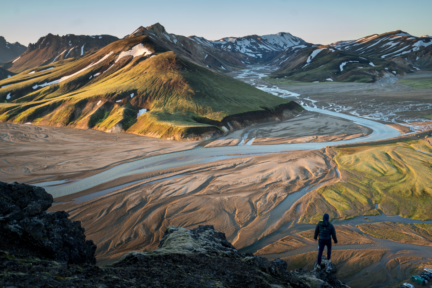
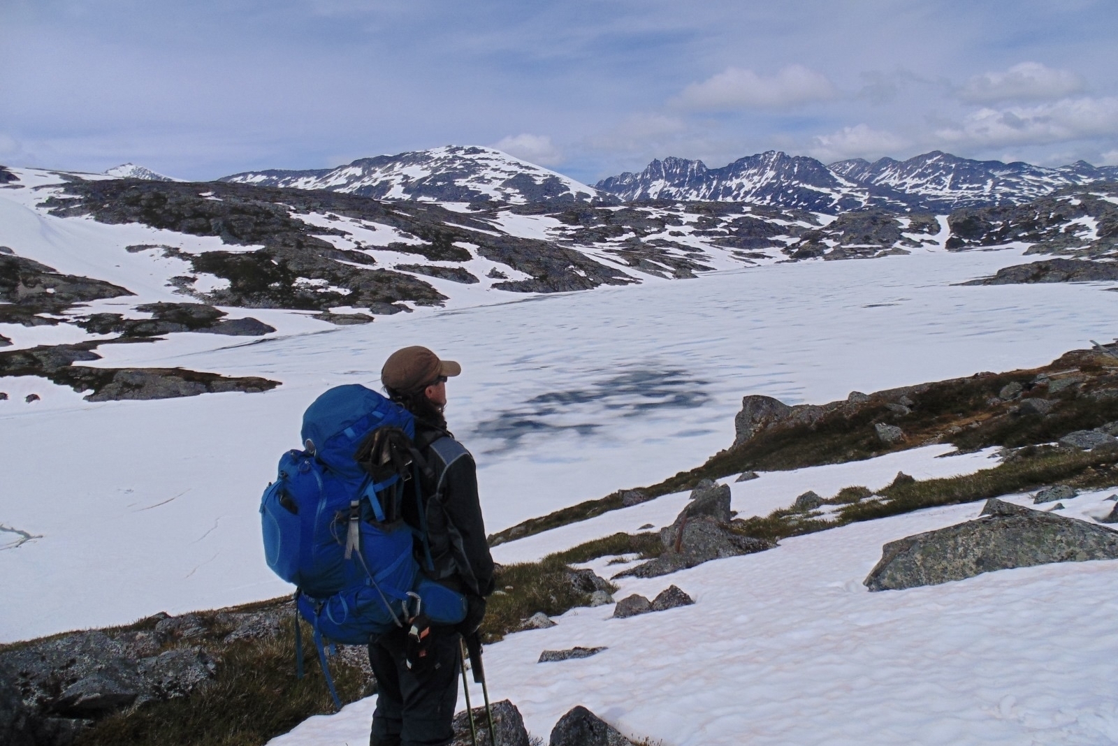
Just when I thought Iceland couldn’t get more dramatic and beautiful, I went and did the Laugavegur Hiking Trail. It’s a showcasing of everything that the Land of Fire and Ice is about. The terrain runs the gamut from lunar-like scree plains colored jet black to crumpled mountains and ice-covered volcanoes. There’s barely a moment when you’re not gasping and sighing at the landscapes unfolding before you.
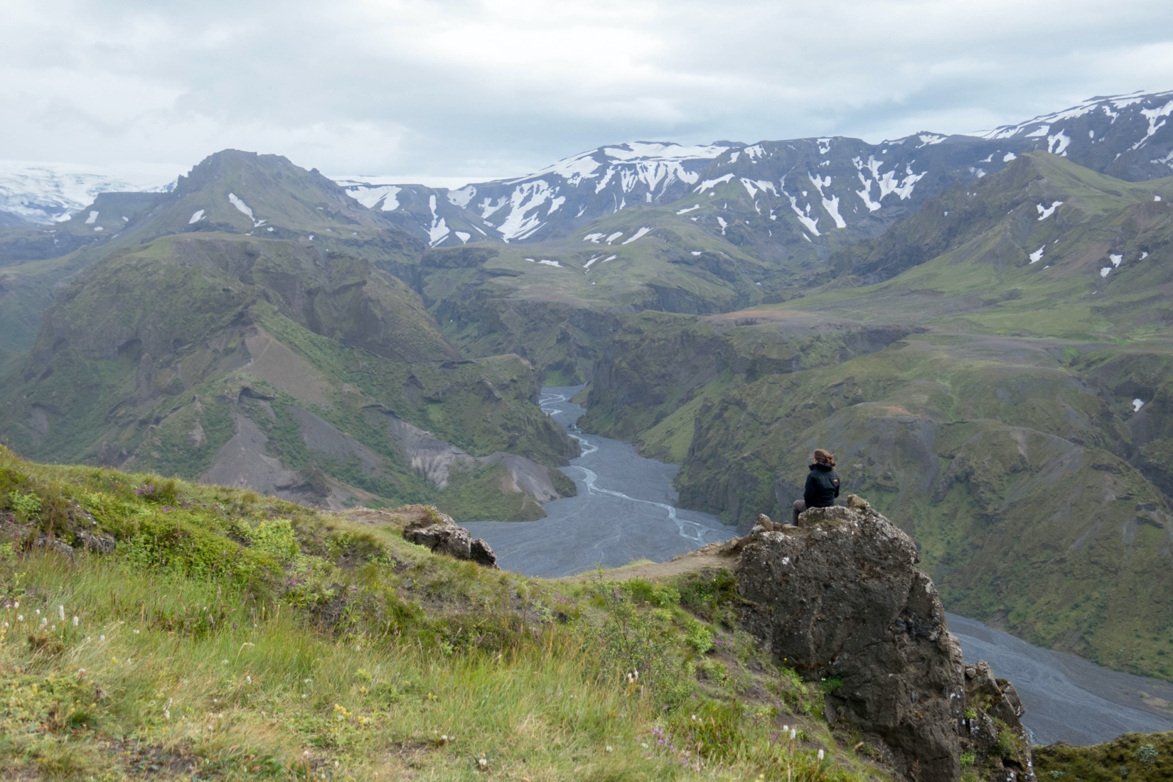
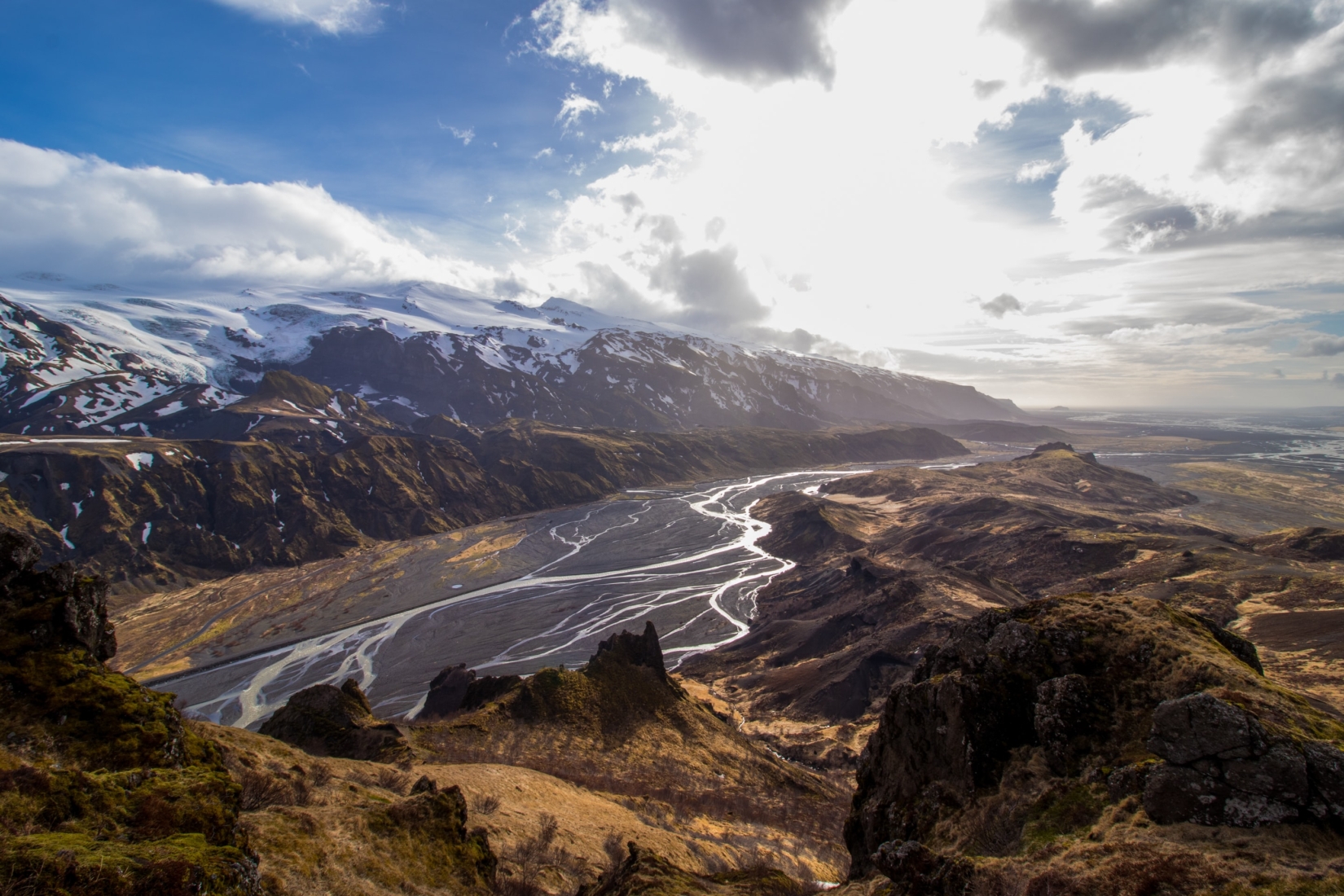
The personal highlight for me was the last day’s approach to Thórsmörk. I remember seeing the colossal ice cap of Mýrdalsjökull rising overhead and the smaller cap of Eyjafjallajökull glimmering a touch to the west. Like sleeping giants, they keep watch over a big gorge that carries a freezing river all the way to the sea. Truly, one of the best places to visit in Iceland.
Inside this Guide
- Where is the Laugavegur Trail?
- Is it worth it? (Key sections and highlights)
- Laugavegur Trail folklore, history, and wildlife
- How long is the Laugavegur Trail? (How many days are needed?)
- Terrain and elevation on the Laugavegur Trail
- Is the Laugavegur Trail difficult?
- Getting to the start of the trail
- When is the trail open?
- The best time of year to go (Seasons guide)
- What should I pack for the Laugavegur Trail?
- Where to stay on the trail (Mountain huts and camps)
- Permits for the Laugavegur Trail
- A sample Laugavegur Trail Itinerary
- The extension to Skógar (the Fimmvörðuháls Trail)
1. Where is the Laugavegur Trail?
The Laugavegur Hiking Trail covers a beautiful area in the Southern Region of Iceland. It goes from the hot springs at Landmannalaugar to the glacial valley of Thórsmörk. The trailhead is located within an easy-to-travel distance of the capital of Iceland, Reykjavik.
2. Is it worth it? (Key sections and highlights)
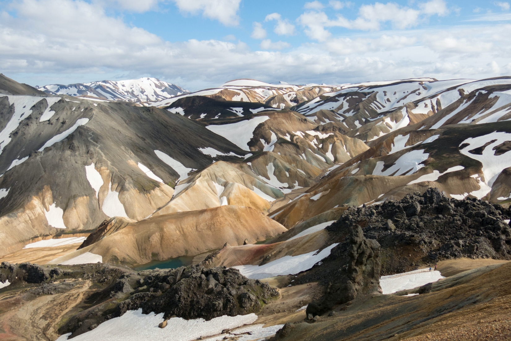
The Laugavegur Trail is one of the best ways to appreciate the raw power of Icelandic nature. Over the course of three or four days, you’ll move from the empty valleys of the highlands into the shadow of the great glaciers that reside by the Atlantic Ocean. If the weather is good, you’ll witness a real array of habitats, including lava fields and carved river gorges that make Iceland famous. Most hikers agree that the highlights of the trail are:
- The view south from Jökultungur after the Hvanngil Hut – Just outside Landmannalaugar, expect a sweeping dash of Southern Iceland, with three glaciers in view and serrated mountaintops above a black-rock valley bottom.
- The final approach to Mýrdalsjökull and Eyjafjallajökull – Hiking towards Thórsmörk, the last day of walking takes you right underneath these two huge glaciers, both of which sit atop active volcanic calderas.
- The optional addition of a hike over the Fimmvörðuháls pass – Navigate two volcanic mountains to the remote village of Skógar (only 25 inhabitants!) on this extension to the main hike and explore even more of the splendors of Iceland.
It’s these stunning and varied views that help the Laugavegur stand out from the crowd.
3. Laugavegur Trail folklore, history, and wildlife
Iceland is home to a rich tapestry of folklore. From trolls to fairies, natural spirits to haunting ghosts in the smoky, volcanic ground, there are tales of all sorts. If you’re interested in that sort of thing then you won’t want to miss a stop at the folk museum and church at Keldur. They offer a glimpse at a traditional Icelandic turf house, once used by the heroic Oddi clan of Iceland around the 12th and 13th centuries. For more travel ideas, check out my other recommendations for best places to visit in Iceland blog.
You might be surprised at the lack of wildlife you encounter on this trip. That’s actually part of the point. These are barren, inhospitable landscapes – think fire-blasted lava fields and snow-suffocated plains. They’re not the best places to go on safari, but they are sure to wow with their sheer ruggedness and raw beauty. (If you’re looking for wildlife, there are plenty of incredible hikes and stunning adventures such as Patagonia’s W Trek)
The Laugavegur Trail is a well-trodden path that is the longest hiking trail in Iceland and also one of the most popular. But it’s not new. It includes a variety of huts that have been hiker stopovers since at least the 1960s. They can help you enjoy a landscape that has itself been millions of years in the making. Yep, the rhyolite mountains, hot springs, and lava fields here are the product of millennia of geological movements and metamorphosis.
4. How long is the Laugavegur Trail? (How many days are needed?)
The Laugavegur Hiking Trail is typically a three-night, four-day trek. You can take longer if you’d like, though four days’ worth of hiking is usually enough to stick to quite a relaxed pace. Lots of people will also extend it to a five- or six-night expedition to include the rather fantastic ascent and descent of Fimmvörðuháls between Thórsmörk and Skógar, that promises to be something truly beautiful as you gaze upon deep gorges and glaciers up close.
5. Terrain and elevation on the Laugavegur Trail
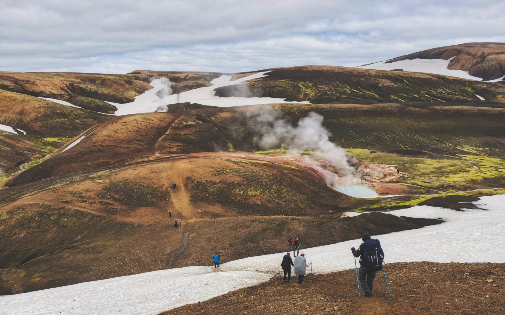
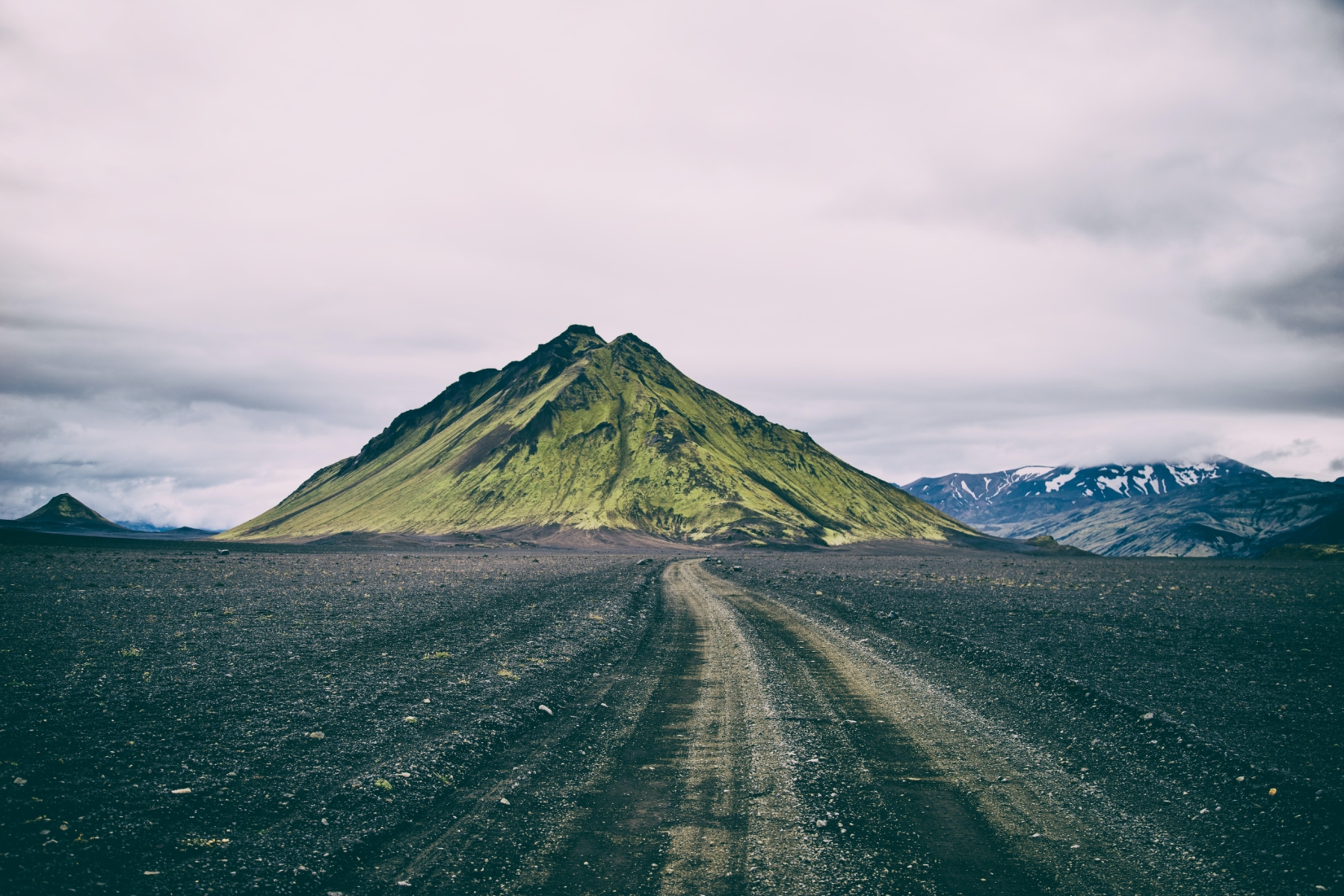
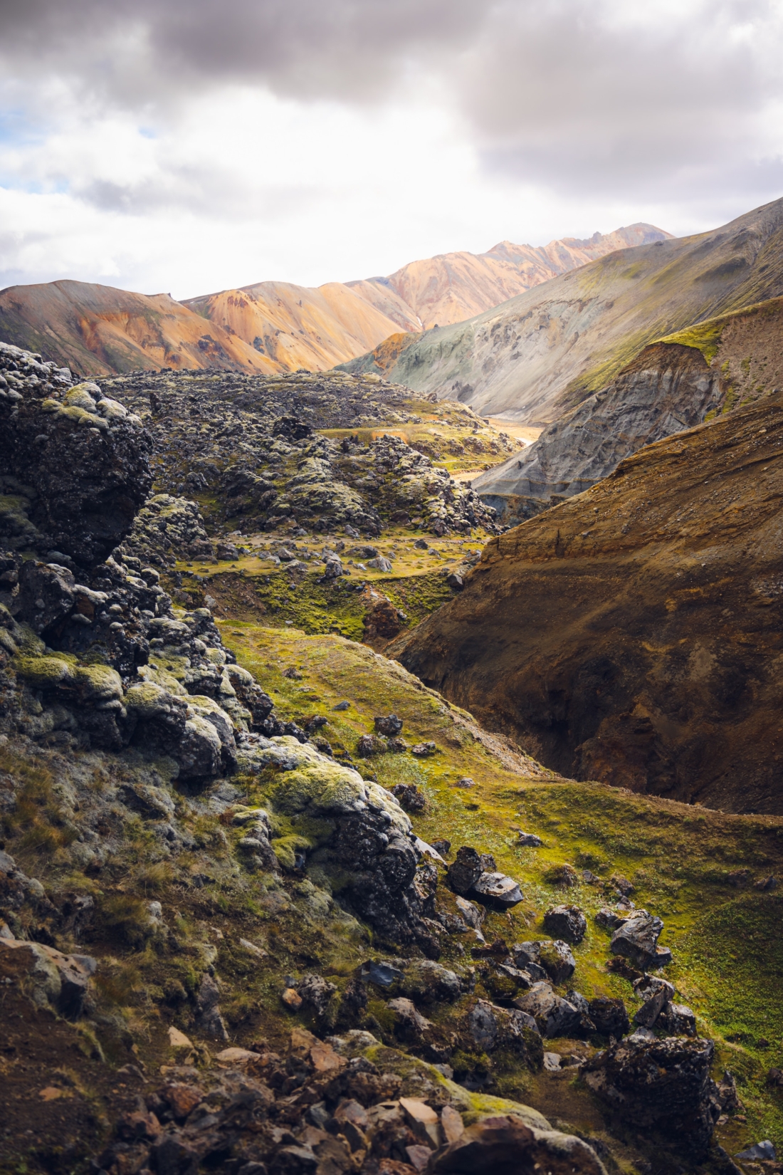
With such a variety of landscapes on offer here, there’s a whole host of stunning terrain types en route. Every day provides a glimpse of something unique – ancient volcanic rock formations, frozen lava fields, glaciers, natural hot springs, black arctic deserts, and even steaming sulfuric riverways. If you pick the right time of year and get good weather, you’ll encounter every color on the spectrum!
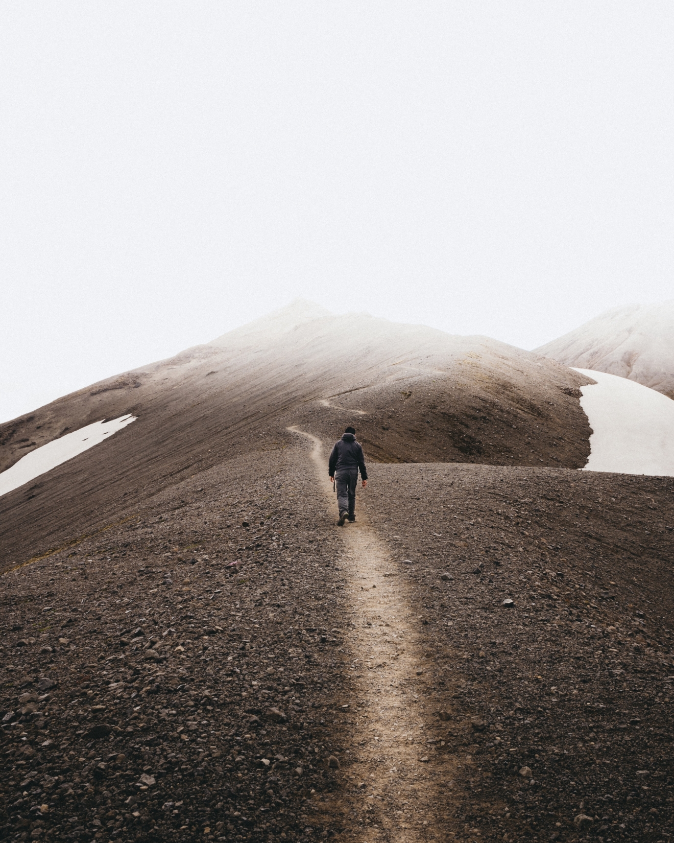
Underfoot, the terrain is generally very accessible to hikers, but tricky spots with steep hills and unbridged rivers do exist. Snow is often the biggest risk. It can clog up the path and slow down hikers even as late as June in the summertime. Winter is much more unpredictable, with heavy snowfalls and sudden rains turning parts of the path into something a whole lot more challenging.
The elevation is highest on the first day of the hike. The trailhead is at 1,706 feet (520 meters) but you begin with an ascent to 3,474 feet (1,060 meters) before immediately dropping back to under 2,000 feet (610 meters) at Álftavatn Lake. You stay at about that level until the last day, when you descend even further to less than 1,000 feet (305 meters). Those who choose to add on the additional hike after Thórsmörk towards Skógar via the glacial area of Fimmvörðuháls will need to conquer a very steep hike up to 3,504 feet (1,070 meters) and then back down again in just two extra hiking days.
6. Is the Laugavegur Trail difficult?
I’d rate the Laugavegur Trail as a moderate level hike. The path itself isn’t overly exhausting, except perhaps for that big altitude gain on day one. It’s also very well marked, and the classic four-day format helps to cut down average hiking distances to just 8.5 miles (13.7 kilometers) per day.
The real issue here is the weather. This part of Iceland is notorious for its heavy rainfall and unpredictable conditions. The initial stage of the path out of Landmannalaugar suffers from extreme mists which can obscure waymarkers and make navigation difficult. That’s followed by a section of highland terrain that’s very commonly hidden under snow, and can be until well into the summer months. Finally, the area around Thórsmörk is one of the wettest in the country, with rain clouds forming on the volcanoes above and an estimated 10 to 30 feet (3 to 9 meters) of precipitation annually. Just be sure to come prepared!
7. Getting to the start of the trail
The Laugavegur Hiking Trail starts in Landmannalaugar and ends in Thórsmörk. The drive from Reykjavik to the natural geothermal pools of Landmannalaugar, also known as the “People’s Pools,” takes about three hours by road. Because this is a one-way trek, it doesn’t really make sense to do that with your own vehicle – you’ll have a nightmare getting back to where you left the car.
That leaves two options: Get to the start of the trail by bus or choose to go on a guided tour. We highly recommend the latter because everything will be planned for you. Transfers will be ready and waiting at your hotel in Reykjavik or even at the airport when you land.
My expert team at The Explorer’s Passage, the premier adventure tour company on the planet, can arrange all this for you. We will whisk you right to the beginning of the trek in comfortable vehicles driven by experienced drivers, and it’s good to note that these Icelandic F-roads are the sort of roads that need experienced drivers!
Those who go with the bus option will need to book tickets for themselves either before getting to Iceland or once they get to Reykjavik. There’s now a dedicated Hiking Passport ticket on offer from most bus operators that includes a drop-off at a trailhead and a pick-up at nominated finish points along the route. Of course, going that way means you still need to organize all the other aspects of your trek, from hut stays to evening meals. Plus, the public hiking buses fill up super quickly and are often totally booked out even before the season begins.
8. When is the Laugavegur Trail open?
Technically speaking, the Laugavegur Trail doesn’t actually close for any part of the year. However, the roads to the trailhead and the huts that offer accommodation along the way do. They’re only open for the main hiking season, which lasts from June to September. Taking 2022 as an example, the huts opened on June 15th and closed again on September 15th.
9. The best time of year to go (Seasons guide)
Because the weather is the number one hurdle on the Laugavegur Trail, picking the right time of year for your adventure is key. So, when should you do the Laugavegur Trail?
As a general rule, the best time of the year to hike the path is the middle of summer into early autumn (mid-June, July, August, and September). That’s the peak tourist season in Iceland, so don’t expect to be totally alone. However, these months bring more sunshine, more daylight (in fact, a touch too much this far north!), and a smaller chance of snowfall and rainfall.
They’re also the only months that the hiking huts along the route and the access roads to the trailhead are fully open. It’s wise to pre-book your huts and campsites if you’re coming in the summer because the trail sees the majority of its 8,000 yearly hikers in these two short months.
Winter hiking on the Laugavegur Trail isn’t really possible. People who prefer the relative solitude of shoulder-season hikes have done it but it’s generally very rare indeed; typically reserved for organized expeditions with good experience working in sub-zero conditions with high winds.
The first tourist groups tend to hit the trail in the late spring, but they’re limited to backcountry camping since the huts aren’t open at that point. Plus, the weather is still very unpredictable then and you would need to prepare for more changeable Icelandic conditions as snow and rain and strong storms can become a real hazard. As such, we recommend hiking the trail around the months of July and August.
The Explorer’s Passage treks on the Laugavegur match up with arguably the very best season of all, running from mid-June to mid-September. Importantly, our packages also include all of your hut bookings, which is key on a route where dates fill up fast. We can’t guarantee the weather but we can guarantee you’ll have somewhere to rest up nicely after a long day of hiking on the exposed Icelandic plateaus!
10. What should I pack for the Laugavegur Trail?
The Laugavegur Hiking Trail actually demands a pretty varied packing list. That’s mainly down to the changeable weather conditions you can expect on your hike. Our best advice is to pack gear that can protect against torrential downpours and thermals to insulate against snowstorms. What’s more, you can’t really skip any of that by traveling in the height of the summer, because the climate is so unpredictable in this corner of Iceland that it’s possible to see blizzards even in August.
At the very minimum, we’d recommend a strong heat-retaining underlayer, fleece layers for your upper, outer waterproof layers (very important), head covers, and gloves. People hiking in the summer months can usually get by using trail running shoes, but wetter times of year require thicker hiking boots with a high-rise angle and possibly even spikes and crampons in case of snow.
You’ll also need to carry a sleeping bag for the huts along the way (more on those later). If you’re planning on camping, then a lightweight hiking tent, a sleeping mat, and a thicker sleeping bag will be needed. However, if you are traveling with us to the Laugavegur Hiking Trail, we can help you with this gear. Feel free to contact my team of adventure consultants with all your packing questions!
11. Where to stay on the trail (Mountain huts and camps)
The mountain huts on the Laugavegur Hiking Trail are generally of very high quality. They offer a warm, dry place to rest for the night as you make your way through this rugged Icelandic terrain. These huts tend to include a large sleeping hall, a kitchen, warden’s quarters, and storage. You can also expect them to come equipped with gas stoves, utensils, and cold running water.
For those who prefer the outdoor experience more in line with a true Icelander, many of the huts also have a campsite. However, we wouldn’t recommend going under canvas unless you’re hiking in the peak summer season – shoulder seasons are just too cold. Generally, the warden of each hut is present only during the summer, so the rest of the year, you are required to be respectful and make use of the site appropriately and responsibly.
The huts normally don’t open for reservations until mid-June, when the roads to the highlands open. The road to the highlands is usually closed until the 15th of June, and sometimes longer, and around mid-September the conditions start to become rough again.
Some of the most common huts used by trekkers on the Laugavegur path include:
- Landmannalaugar Hut – Either the start or finish of your journey depending on if you go north-south or south-north, the current hut on this site was built in 1969, holds 75 people, and is located approximately 1,960 feet (600 meters) above sea level. It sits right at the edge of the Laugahraun lava field and has access to its own hot springs.
- Hrafntinnusker Hut – The hut on Mount Hrafntinnusker was built in 1977 and stands 3,370 feet (1,027 meters) above sea level. It’s close to some magical ice caves and has stunning views of snow-dashed highlands. This one can accommodate up to 36 people, though of course more will be admitted in bad weather. There’s geothermal heating and running water when the warden is present.
- Álftavatn Hut – The huts at Álftavatn Lake were built in 1979 and can accommodate up to 58 people in sleeping bags. One hut is specifically reserved for those hikers traveling between Thórsmörk and Landmannalaugar.
- Emstrur Hut – A cluster of about five cabins on the mountain slopes close to the South Emstrua River, complete with gas stoves and cold running water. There’s also an adjoining campsite in the valley just below.
- Hvanngil Hut – This hut sits near a church and the ancient farmhouse site of Keldur. It accommodates up to 70 people. The road from the hut continues across the Langviu Lava Field, River Markarfljot and past Lake Álftavatn.
- Húsadalur Thórsmörk Hut – Known as the Volcano Huts, these cozy cabins have access to a lava grill where you can eat local cuisine. They’re also close to a multitude of trails that wind their way through the lava landscape, offering a chance to do a bona fide Iceland volcano hike.
- Básar Thórsmörk Hut – Built between 1980 and 1981, these huts were some of the first commissioned by the Touring Association Utivist, one of the first Icelandic outdoor travel organizations.
- Skagfjörðsskáli Langidalur Thórsmörk Hut – Located in the flat area at the mouth of Langidalur Valley, the huts here are just a moment away from the sparkling river Krossa, one of the best places to go in Iceland. The route here will require a robust vehicle from road number 1, and travelers should be aware of the un-bridged rivers in the area. The whole region is a mecca for hikers, offering access to the Laugavegur Trail and a number of other day hikes.
In terms of costs, the huts vary in offerings and accommodations. Our travel experts can direct questions on price and bookings.
12. Permits for the Laugavegur Trail
You don’t need to pre-book permits to walk the Laugavegur Trail like you do on, say, the Inca Trail. However, you will have to pre-book your stay in the huts along the way. My team can arrange this for you, which will take all the hassle out of it for you.
We’d recommend getting your bookings sorted as early as possible (6 to 9 months ahead), especially if you’re planning a trip in the peak season between June and August. It’s normal for huts to fill to capacity during that time – this is one of the most popular hikes in Iceland, afterall!
Finally, it’s only possible to book huts in a north-to-south order during the high season (hence our focus on the Landmannalaugar to Thórsmörk route, with a potential extension to Skógar at the end should you care to extend your adventure).
Campers should have an easier time booking because the sites aren’t in such high demand as the huts. However, we’d still recommend pre-booking pitches, if only to give yourself a destination to target at the end of each day’s hike.
13. A sample Laugavegur Trail itinerary
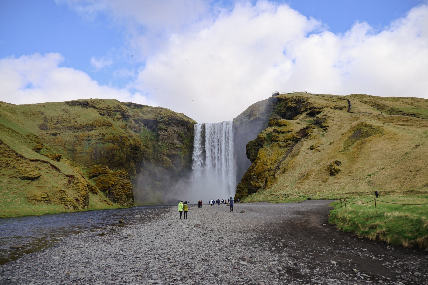
A typical Laugavegur Trail itinerary goes from north to south across the heart of Iceland’s Southern Region. As noted, the starting point of the hike is at Landmannalaugar and the finishing point is Thórsmörk. However, lots of hikers will also choose to add on the two-day hike over the next pass to Skógar, which drops in some seriously dramatic mountainscapes with visions of volcanoes up close. If you do head to Skógar, don’t forget to check out Skógafoss – a stunning waterfall!
Here’s a breakdown of what to expect each day and our picks on some of the best places to visit:
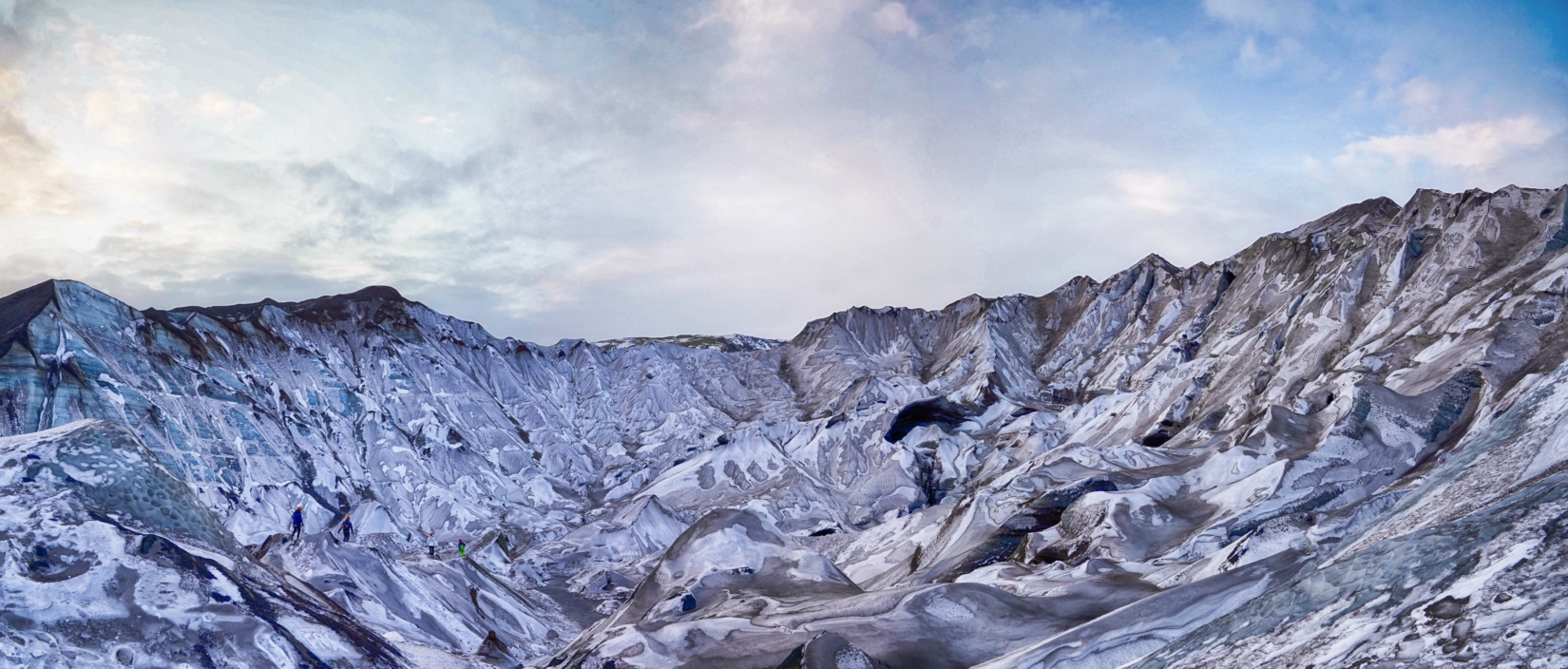
- Day 1 – Landmannalaugar to Hrafntinnusker – The highest-altitude part of the trail takes you from the hot springs of Landmannalaugar through a very exposed landscape of rock-ribbed slopes. The whole day is generally uphill, with the goal being the Mars-like bowl in the central highlands where the remote Hrafntinnusker Hut resides at 3,370 feet (1,027 meters).
- Day 2 – Hrafntinnusker to Hvanngil – One of the longest days on the trail but largely downhill and losing altitude. Today, you drop from the lunar-like scree ridges and their pockets of snow to the grass-clad plains and black-rock valleys. Highlights are the first sightings of the great volcanos to the south, and the shimmering lake of Álftavatn (there’s also a hut there to stop for the night if you’re doing the trail in five days).
- Day 3 – Hvanngil to Emstrur – You could be forgiven for thinking that you’d been transported to the set of a Hollywood Sci-Fi epic on Day 3 – the landscapes are pure alien, as you enter a wide valley flanked by the odd shark-fin fell. If it’s clear (not too often), you should also be able to make out the two mighty volcanoes and their ice caps approaching in the distance.
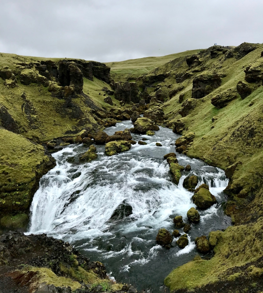
- Day 4 – Emstrur to Thórsmörk – The final day takes you into the lower plains around Thórsmörk. This is a land carved up by canyons and rivers, where the mountains are dashed with pockets of lush mosses and lichens. The defining feature has to be the forever-dominant presence of Eyjafjallajökull volcano looming overhead.
Do you anticipate to still be brimming with energy after four days crisscrossing the inhospitable highlands of Southern Iceland? Good for you! The good news is that there’s a pretty awesome extension on offer at the finishing point of the Laugavegur Trail. Check it out below.
14. The extension to Skógar (the Fimmvörðuháls Trail)
The Fimmvörðuháls Trail and adds roughly a whole extra day or two to the standard itinerary. It begins in the moss-caked glacial valley of Thórsmörk and finishes up on the ocean side of the mountains over in Skógar. One glance at the map will show you that means crossing over the mighty south slope of Eyjafjallajökull volcano, which you’ll do via the Fimmvörðuháls pass.
It’s a very steep ascent on loose scree ridges and is probably a touch harder than any sections on the Laugavegur Trail proper. The reward is an up-close view of some of Iceland’s most active volcanoes, plus a visit to the incredible Skógafoss Waterfall to cap off your adventure – that’s one of the most jaw-dropping natural wonders on the whole island!
Incredible natural beauty awaits you on your journey through Iceland. Hiking the world famous Laugavegur Trail offers an immersive experience into some of the most majestic landscapes on Earth. If you are interested in learning more about our Laugavegur Trail Adventure you can CLICK HERE!
If you’re new to TEP, click here to learn more about us and our other world-class adventures. Don’t forget to check out our client testimonials and 5-star TripAdvisor rating!
I look forward to seeing you on the trail.
Cheers,
Jeff
Jeff Bonaldi
Founder & CEO
The Explorer’s Passage
About Jeff Bonaldi
Jeff Bonaldi is the Founder and CEO of The Explorer’s Passage, a premier adventure travel company. His mission is to provide travelers with the opportunity to transform their lives and the planet through the power of adventure.
Learn more about Jeff’s story and his company HERE.